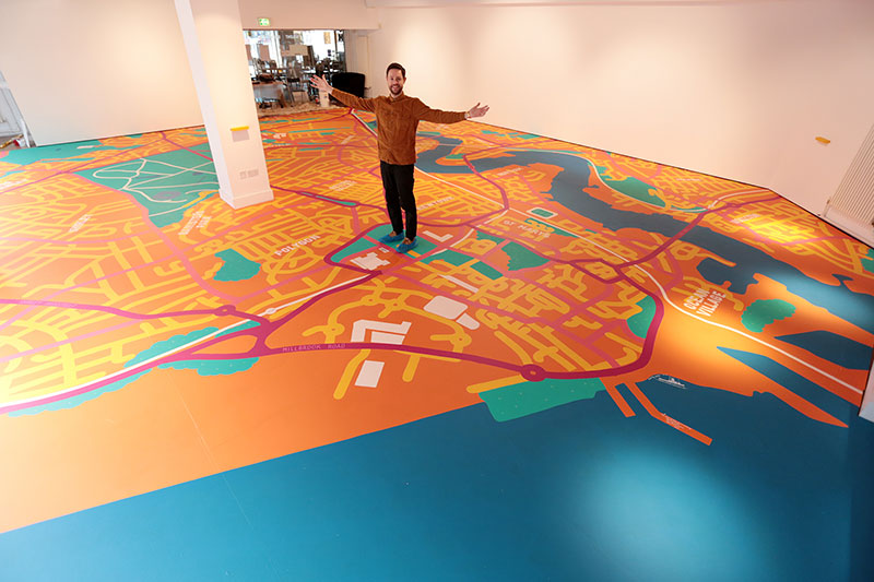
How do you paint a 120 sqm to scale map of Southampton on the floor by hand!? With a partnership with major mapping organisation Ordnance Survey. Artist Nathan Evans painted this huge 10m by 12m map onto the floor of the gallery using projections from the ceiling kindly made by Ordnance Survey.
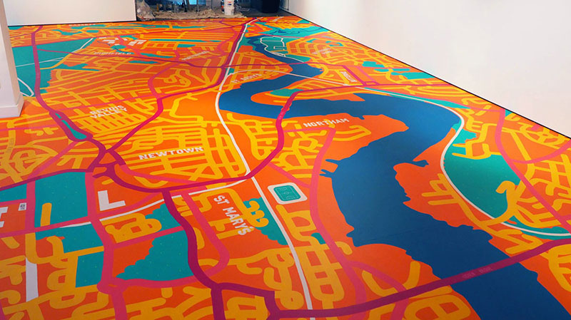
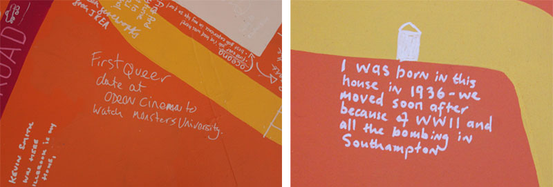
Solent Showcase Gallery continued to create shows with experimental non-traditional exhibition techniques with more ambitious and risky participatory elements. If a geographical map invites you to travel, then our map invited you to remember, share and discover. The gallery invited people to walk through the space, find places and spaces they know and love and add their stories directly which created a fully immersive, visual map of the city, for and by the people who work, live and visit here.
We hoped Make Your Mark would change the way people think about a place and the city itself, by unveiling the smallest, most non-descript spaces – bringing to life the people and stories who inhabit them.
Interestingly, the gallery received many unique visitors to the exhibition due to people watching the development of the map on the floor day by day through the big department style windows on our front. This added another element of accessibility to the gallery space, a ‘behind the scenes’ moment people walking to work or passing by could enjoy without having to make a decision of passing through the door of a gallery.
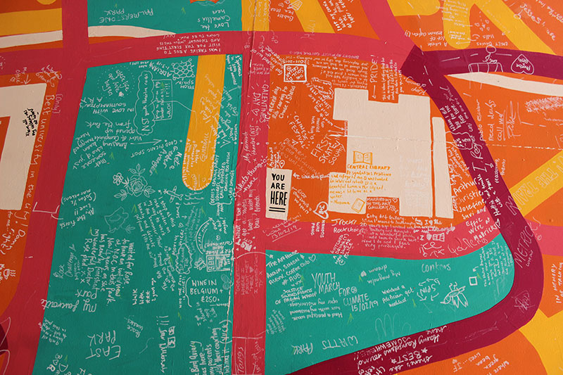
Part oral history, part folklore, a collective homage, Make Your Mark intended to help people to rethink what Southampton means to its citizens, drawing on its hidden experiences, its contemporary social geography and its future.

Back to top